")
")
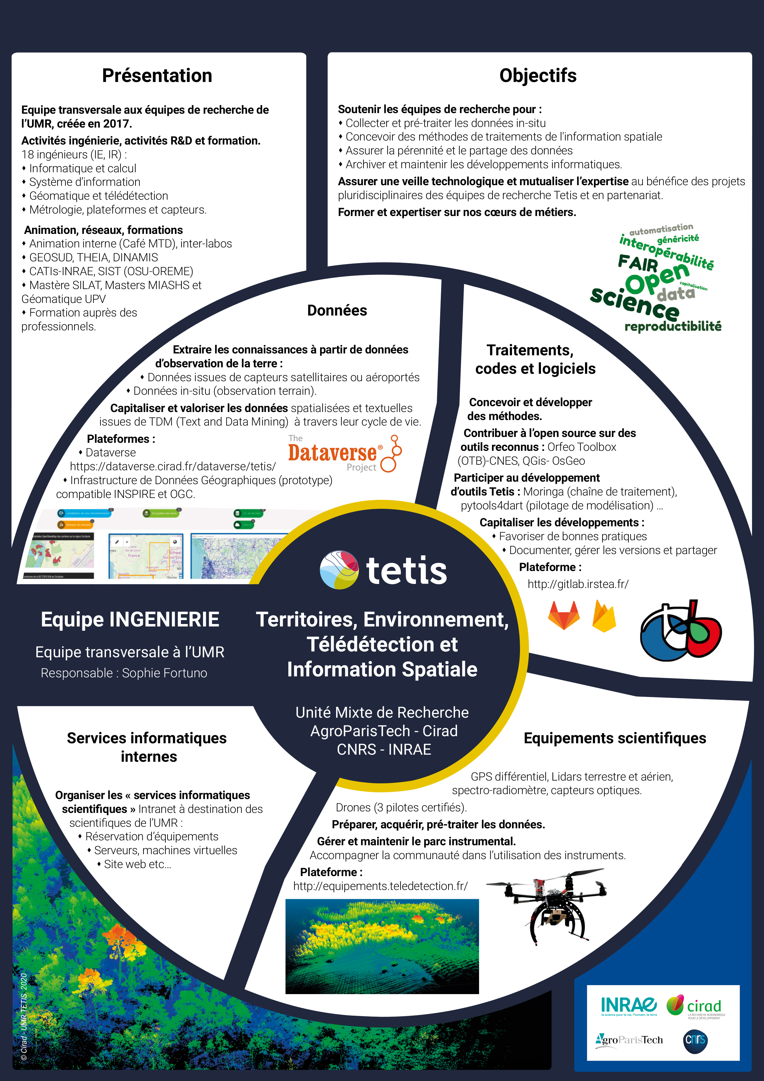
Transversal Team
Team Engineering
The Engineering team cuts across the three UMR TETIS research teams. It brings together permanent and temporary design engineers and research engineers in a variety of complementary disciplines such as computing, information systems, geomatics, remote sensing, metrology, geography, ecology and training.
The main tasks of this team are :
- Capitalising on and exploiting the data and codes produced by the UMR.
- Support for data collection and processing.
- Promoting open science.
- Management of scientific equipment.
- Sharing knowledge.
The team contributes to 4 areas of activity:
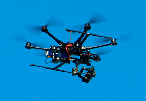
1 . Scientific equipment
- Differential GPS, terrestrial and aerial lidar, drones…
- Manage and monitor the stock of scientific measuring instruments: web-based management and reservation application;
- Acquire, process and preserve geolocation data;
- Platform :
⬪ Go to Equipment
⬪ Go to Productions Équipements
⬪ Go to Productions Équipements
2 . Data
Spatial data: from observation, sensors, models, etc. Text and Data Mining (TDM) data
- Capitalise : preserve, standardise, document, define conditions of use (licence)
- Adding value: disseminating as part of open science
- Platforms :
⬪ Go to Dataverse Inrae
⬪ Go to Dataverse CIRAD
⬪ Go to Dataverse CIRAD
Geographic Data Infrastructure (GeoNetwork catalogue + GeoServer map server). Compatible with the INSPIRE directive
Codes, software, models, processing chains, applications...
- Website :
⬪ Go to IDG Tetis
3. Code, software...
Codes, software, models, processing chains, applications...
- Accompanying : Developer guide
- Capitalising : preserve, standardise, document
- Distribute : the code
- Platforms :
⬪ Go to Gitlab Irstea
⬪ Go to Platform Productions
⬪ Go to Platform Productions
4. Catalogue des services informatiques
Reorganisation of the "IT services" offered by the supervisory bodies, MTD and Tetis.
- Describe the IT services available.
- Distribute the catalogue of services on the UMR intranet